
Free Camping in California, Utah & Arizona: Best Spots
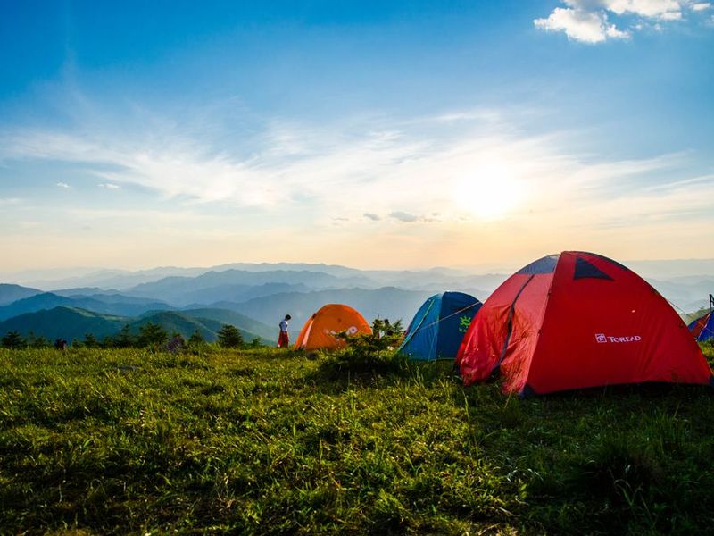
The American Southwest is the holy grail of free camping. Across California, Utah and Arizona, millions of acres of Bureau of Land Management (BLM) and National Forest (NF) land let you pull off a dirt road, set up a tent or van, and wake up to red rock or pine forest without paying a cent. The catch? "Free" is not "anywhere, anyhow." Land ownership changes every few hundred feet, limits are real, and the best spots vanish once the secret spreads.
This guide names the actual places worth driving to, when to go, and the rules that keep you from a ranger knock on the door. If you are new to dispersed camping, read our BLM vs National Forest rules comparison first, then come back here with a route.
What "free camping" actually means here
Nearly all the spots below are dispersed campsites — no developed pad, no picnic table, no flush toilet, often no cell service. You camp on public land away from established campgrounds, usually within 100 to 500 feet of a dirt road, and you pack out everything you pack in. The standard ceiling on public land is 14 days of camping in any 28-day period, after which you must move at least 25 miles. We explain that fully in the 14-day rule guide.
A few free areas are also Campground-hosted but fee-free National Forest sites, and a handful are Long-Term Visitor Areas (LTVA) that charge only in peak winter. Know which one you are in before you relax.
California: where to boondoggle for free
Eastern Sierra (Inyo & Sierra National Forests)
The Eastern Sierra around Lone Pine, Bishop and Mammoth is California's dispersed-camping capital. Reliable free zones include Benton Crossing Road and the dirt roads off Whitney Portal Road west of Lone Pine (wide open sagebrush flats with a view of Mount Whitney), Goodale Creek and Browns Camp along Highway 395, and the Crowley Lake shoreline volcanic tableland. Near Mammoth, dispersed sites branch off Lake Mary Road above the pay campgrounds and along McGee Creek. Best window: May through October; high roads close after the first snow.
Mojave Desert & BLM (Southern California)
For Joshua Tree without the campground fees, head north into the Mojave: Jawbone Canyon and Dove Springs off Highway 14, Stoddard Valley near Barstow, and the open flats around Giant Rock in Landers. These are BLM lands with OHV traffic, so pick a quiet corner. Summer highs exceed 100°F (38°C), so target October through April. Note that dispersed camping inside Joshua Tree National Park itself is not allowed — you need the national forest or BLM buffer outside the boundary.
Los Padres & Angeles National Forest
Closer to LA, Angeles Crest Highway and Upper Big Tujunga Canyon in Angeles NF offer pine-shaded dispersed pulls, popular in spring and fall. Further south and coastward, Los Padres National Forest around Big Sur, the Santa Ynez range and Santa Barbara backcountry has dozens of primitive spots; expect narrow roads and fire closures in late summer. Check the US Forest Service alerts before driving up — Angeles and Los Padres close fast when fire risk spikes.
Utah: red rock on the cheap
Moab and the Colorado River corridor
Moab's paid campgrounds book solid months out, but free land hugs the edges. Highway 128 along the Colorado River once had endless free pulls; today much of it is permit-managed or restored, so target the designated dispersed zones further out, around Bartlett Flat, Professor Valley and the Flat Iron Mesa dirt roads. South of town, Canyon Rims Recreation Area does charge a fee, so do not confuse it with true free land. Go March–May or September–October; Moab summers routinely top 100°F.
San Rafael Swell
If you want solitude, the San Rafael Swell is Utah's best-kept free secret. This huge BLM expanse between Green River and Price allows dispersed camping almost anywhere away from marked archaeological sites — try the roads toward The Wedge overlook, Eagle Canyon and Jailhouse Springs. There is no water, no cell service and no fee. A high-clearance vehicle helps, though many spots are reachable in a regular car off Interstate 70.
Grand Staircase–Escalante & Bears Ears
Within Grand Staircase–Escalante National Monument, primitive camping is allowed along Hole-in-the-Rock Road and Cottonwood Canyon Road, and the broad Devil's Garden area off Highway 12. Near Bluff, the Valley of the Gods (BLM) lets you camp beneath the buttes for free — just stay off the pavement and existing pull-outs. Moki Dugway and Comb Ridge nearby add dramatic cliffs. Spring and fall are ideal; summer is hot and winter can snow in the higher elevations.
Arizona: desert forest and boondocking hubs
Flagstaff & Sedona (Coconino & Kaibab NF)
The high country around Flagstaff is Arizona's green escape. Schultz Pass Road east of town offers classic pine dispersed camping and fills on weekends; quieter options spread toward Mountainaire and the dirt roads around Canyon Point. Around Sedona, dispersed camping is heavily restricted to protect the watershed, so do not assume you can pull off every scenic road — use the Coconino NF Motor Vehicle Use Map. Near the North Rim of the Grand Canyon, Kaibab National Forest (around De Motte Park and the Rainbow Plateau) gives free pine camps minutes from the park entrance without the park fee. Best season: June through September.
Mogollon Rim & Tonto National Forest
East of Phoenix, Forest Road 300 along the Mogollon Rim is a long, scenic line of free dispersed sites near Payson and Sedona's high side. It is hugely popular with Arizonans escaping the heat, so arrive early on weekends. Summer nights are cool here even when Phoenix bakes.
Western desert & Quartzsite (LTVA)
From late November to March, western Arizona becomes the nation's boondocking capital. Around Quartzsite, Bouse, Hope and Parker, vast BLM Long-Term Visitor Areas host snowbird RVs for a small seasonal fee (or shorter free stays outside the LTVA fee season). For solitude without crowds, Kofa National Wildlife Refuge south of Quartzsite offers rugged desert free camping and bighorn sheep. Avoid this region May through September — the heat is dangerous, not merely uncomfortable.
Season cheat-sheet at a glance
| Region | Best window | Avoid |
|---|---|---|
| Eastern Sierra, CA | May–Oct (high roads open) | Nov–Apr snow closure |
| Mojave / Joshua Tree edge | Oct–Apr | Jun–Aug 100°F+ heat |
| Moab / Southeast Utah | Mar–May, Sep–Oct | Jun–Aug extreme heat |
| Flagstaff / Kaibab high country | Jun–Sep | Dec–Apr snow |
| Western AZ / Quartzsite | Nov–Mar snowbird season | May–Sep lethal heat |
Rules that keep you legal
- Confirm the land. Use the onX Offroad, GAIA or the official BLM/NF Motor Vehicle Use Maps before you set up; a posted sign, a fence or a private inholding can end free camping abruptly.
- Stay within 14 days. On most BLM and National Forest land you may camp 14 days in a 28-day window, then move 25 miles. See our 14-day rule breakdown.
- Watch fire restrictions. The West bans open fires constantly in summer. Check our fire restrictions tool and carry a camp stove as your default.
- Outhouse it out. Pack out toilet paper and waste where there is no vault toilet; don't dig cat-holes in fragile cryptobiotic desert soil.
- Leave it cleaner. These spots stay free only if they are not trashed. Read our Leave No Trace guide for dispersed campers.
Key takeaways
- Eastern Sierra (Benton Crossing, Goodale) and the San Rafael Swell are two of the most reliable free zones in the whole West.
- High country (Flagstaff, Kaibab, Mogollon Rim) is a summer escape; low desert (Quartzsite, Mojave) is a winter escape — never the reverse.
- Dispersed camping is free but not unlimited: 14 days in 28, then move 25 miles.
- Always verify land ownership and current fire status on official maps before you unhitch.
Frequently asked questions
Is dispersed camping really free, or is there a hidden fee?
Can I just camp anywhere I see a dirt road?
Do I need a 4WD to reach these free spots?
Sources: Bureau of Land Management state offices (California, Utah, Arizona); U.S. Forest Service ranger districts (Inyo, Angeles, Los Padres, Coconino, Kaibab, Tonto, Dixie); Recreation.gov. Place names and seasons verified October 2026; road status and fire closures change constantly — confirm on official agency pages before departure.
美国西南部是免费露营的圣地。在加州、犹他州和亚利桑那州,数百万英亩的土地管理局(BLM)与国家森林公园(NF)土地,让你可以驶离土路、支起帐篷或停好房车,醒来就是红岩或松林,一分钱不用花。但"免费"不等于"随便停、随便住"。土地权属每隔几百英尺就可能变化,停留限制是真实存在的,而最好的点位一旦传开就会人满为患。
本文点名真正值得专程前往的地方、什么时候去,以及能让你不被护林员敲门的规则。如果你刚接触分散露营,建议先读BLM 与国有林规则对比,再带着路线回到这里。
这里说的"免费露营"到底是什么
下面几乎所有点位都是分散营地(dispersed campsite):没有硬化车位、没有野餐桌、没有冲水厕所,常常也没有手机信号。你在远离正规营地的公共土地上露营,通常在土路两侧 100 到 500 英尺内扎营,并把带进来的一切全部带走。公共土地的通用上限是任意 28 天内露营不超过 14 天,之后必须至少移动 25 英里。完整解释见14 天规则详解。
另有少数免费点是由营地管理但不收费用的国家森林公园营地,还有一小部分是长住访客区(LTVA)——只在冬季旺季收费。放松下来之前,先搞清楚自己身处哪一类。
加州:去哪里免费"荒住"
东内华达山脉(Inyo 与 Sierra 国家森林公园)
从 Lone Pine、Bishop 到 Mammoth 一带的东 Sierra,是加州分散露营之都。可靠的免费区域包括 Lone Pine 以西 395 号公路旁的 Benton Crossing Road 与 Whitney Portal Road 两侧土路(开阔的蒿草滩,直面惠特尼峰)、Goodale Creek 与 Browns Camp,以及 Crowley Lake 湖畔的火山台地。Mammoth 附近,免费点位分布在收费营地之上的 Lake Mary Road 沿线与 McGee Creek 一带。最佳窗口:5 月到 10 月;高海拔道路初雪后即关闭。
莫哈维沙漠与 BLM(南加州)
想绕开约书亚树国家公园的营地费,就往北进入莫哈维:14 号公路旁的 Jawbone Canyon 与 Dove Springs、Barstow 附近的 Stoddard Valley,以及 Landers 的 Giant Rock 周边开阔地。这些是 BLM 土地,常有越野车活动,挑个安静的角落即可。夏季常超过 100°F(38°C),所以目标放在 10 月到次年 4 月。注意:约书亚树国家公园内部不允许分散露营——你需要的是边界外的国有林或 BLM 缓冲带。
Los Padres 与 Angeles 国家森林公园
离 LA 更近的地方,Angeles 国家森林公园内的 Angeles Crest Highway 与 Upper Big Tujunga Canyon 有松荫遮蔽的免费停靠点,春秋季热门。再往南靠海,Big Sur、Santa Ynez 山脉与圣巴巴拉后方的 Los Padres 国家森林公园有大量原始点位;注意路窄、夏末常因防火关闭。开上去之前查 US Forest Service 的预警——火险一高,Angeles 与 Los Padres 关门极快。
犹他州:便宜睡在红岩间
Moab 与科罗拉多河走廊
Moab 的收费营地提前数月订满,但免费土地贴着边缘分布。沿河的 128 号公路曾经随处可停,如今大部分被纳入许可管理或生态恢复,所以把目标放在更远处指定的分散区,如 Bartlett Flat、Professor Valley 与 Flat Iron Mesa 的土路。城南的 Canyon Rims 休闲区是收费的,别和真正的免费地搞混。出行选 3–5 月或 9–10 月;Moab 夏天常破 100°F。
圣拉斐尔隆起(San Rafael Swell)
想要清静,圣拉斐尔隆起是犹他州最被低估的免费秘境。这片介于 Green River 与 Price 之间的广阔 BLM 区域,除了有标记的考古遗址外几乎随处可扎营——可以试试通往 The Wedge 观景台、Eagle Canyon 与 Jailhouse Springs 的土路。没有水、没有信号、也没有费用。高底盘车更方便,但很多点位从 I-70 下去普通轿车也能到。
大阶梯–埃斯卡兰特 与 Bears Ears
在大阶梯–埃斯卡兰特国家纪念区内,Hole-in-the-Rock Road、Cottonwood Canyon Road 沿线,以及 128 号公路旁开阔的 Devil's Garden 都允许原始露营。Bluff 附近,众神之谷(Valley of the Gods)(BLM)让你免费睡在孤峰之下——只要离开铺装路面与既有停车位即可。附近的 Moki Dugway 与 Comb Ridge 还有壮观的崖壁。春秋最理想;夏季炎热,高海拔冬季会积雪。
亚利桑那州:山林与荒漠房车中心
Flagstaff 与 Sedona(Coconino 与 Kaibab 国有林)
Flagstaff 周边的高地是亚利桑那的绿色避暑地。城东的 Schultz Pass Road 是经典的松林分散露营地,周末会满;更安静的选择散布在 Mountainaire 与 Canyon Point 周边土路上。Sedona 周边为保护水源地,分散露营限制极多,别以为随便一条风景路都能停——务必查 Coconino 国有林的机动车使用地图。大峡谷北缘附近的 Kaibab 国家森林公园(De Motte Park 与 Rainbow Plateau 一带)提供免费松林营地,离公园入口仅几分钟,却不用付公园门票。最佳季节:6 月到 9 月。
Mogollon 山脊 与 Tonto 国家森林公园
凤凰城以东,沿 Mogollon 山脊的 300 号林道在 Payson 与 Sedona 高地方向串起一长串免费分散点位。亚利桑那人避暑常来,周末要早到。即使凤凰城酷热,这里夜晚依然凉爽。
西部沙漠与 Quartzsite(LTVA)
从 11 月底到 3 月,西亚利桑那成为全国的房车荒住之都。Quartzsite、Bouse、Hope 与 Parker 周边,广阔的 BLM 长住访客区以低廉的季节性费用接纳过冬房车(在 LTVA 收费季之外则可短期免费停留)。想要人少清静,Quartzsite 以南的 Kofa 国家野生动物保护区提供粗犷的荒漠免费露营,还能看到大角羊。5 月到 9 月避开此地——这里的酷热是危险级,而不只是不舒服。
季节速查表
| 区域 | 最佳窗口 | 避开 |
|---|---|---|
| 东 Sierra(加州) | 5–10 月(高路开放) | 11–4 月积雪封路 |
| 莫哈维 / 约书亚树外围 | 10–4 月 | 6–8 月 100°F+ 酷热 |
| Moab / 犹他东南 | 3–5 月、9–10 月 | 6–8 月极端高温 |
| Flagstaff / Kaibab 高地 | 6–9 月 | 12–4 月积雪 |
| 西亚利桑那 / Quartzsite | 11–3 月过冬季 | 5–9 月致命高温 |
让你合法的规则
- 先确认土地归属。扎营前用 onX Offroad、GAIA 或官方 BLM/国有林机动车使用地图;一块告示、一道围栏或一处私人夹地,都可能让免费露营戛然而止。
- 14 天内。多数 BLM 与国有林土地上,任意 28 天内可露营 14 天,随后移动 25 英里。详见14 天规则详解。
- 留意防火禁令。西部夏季几乎天天禁明火。出发前查我们的防火禁令工具,并默认以露营炉具为主。
- 污物带走。没有旱厕的地方,卫生纸与排泄物全部带走;脆弱的荒漠结皮土壤里别挖猫洞。
- 比来时更干净。这些点位能一直免费,靠的是不被糟蹋。阅读分散露营者的无痕法则。
要点速记
- 东 Sierra(Benton Crossing、Goodale)与圣拉斐尔隆起是整个西部最可靠的两大免费区。
- 高地(Flagstaff、Kaibab、Mogollon)是避暑地;低荒漠(Quartzsite、莫哈维)是过冬地——千万别反过来。
- 分散露营免费但不无限:28 天内住 14 天,再移 25 英里。
- 卸行李前,永远先用官方地图核对土地归属与当前防火状态。
常见问题
分散露营真的免费吗?有没有隐藏费用?
看到土路就能随便扎营吗?
去这些免费点需要四驱吗?
资料来源:BLM 加州/犹他/亚利桑那州办公室;美国林务局各护林区(Inyo、Angeles、Los Padres、Coconino、Kaibab、Tonto、Dixie);Recreation.gov。地名与季节核实于 2026 年 10 月;路况与防火关闭随时变化,出发前请以官方机构页面为准。

50+ Free Overnight Spots50+ 免费过夜点
Read →阅读 →
BLM vs National ForestBLM 与国有林对比
Read →阅读 →
The 14-Day Rule14 天停留规则
Read →阅读 →Find legal free overnight spots near you查找你附近合法的免费过夜点
Filter by state, land type and amenities — free, bilingual, offline-ready.按州、土地类型与设施筛选——免费、双语、断网可用。
Open the overnight finder打开过夜点查询