
BLM vs National Forest Dispersed Camping: Rules Compared
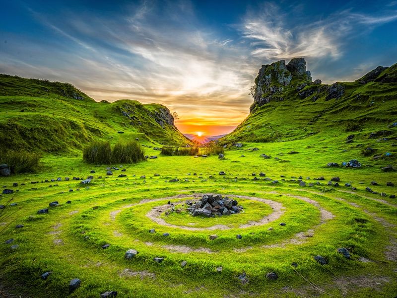
You have seen the maps: a wash of green polygons covering the American West, all of it seemingly free to camp on. But pull off a gravel road and you are actually on one of two very different federal landlords — the Bureau of Land Management (BLM) or the U.S. Forest Service (USFS). The signs at the trailhead may look similar, but the stay limits, fire rules, and even the definition of "dispersed" are not the same. Mixing them up is how a cheap, perfect boondock turns into a citation.
This guide is for van dwellers, RV boondockers, and first-time dispersed campers who want to know, before they drive down that two-track, exactly whose land they are on and what that allows.
Who manages what, and why it matters
The BLM manages roughly 245 million acres, mostly in the West, under a "multiple use" mandate that balances grazing, mining, energy, and recreation. Its landscapes are often low-elevation desert, sagebrush, and open range. Dispersed camping on BLM land is the default: if there is no posted closure or campground fee, you may usually pull off a public road and set up.
The USFS manages about 193 million acres of national forests and grasslands, primarily as timber and watershed lands. Campgrounds are denser, and dispersed camping is often limited to designated corridors around forest roads. The rule of thumb: BLM gives you wide open desert; the Forest Service gives you trees, shade, and a denser network of roads — but also more neighbors and more closure orders.
Is dispersed camping actually free — and legal?
On both BLM and most USFS land, dispersed camping is free by default, with no permit required, provided you are outside posted campgrounds, wilderness closures, and "no camping" corridors. But "default" has asterisks on both sides:
- BLM exceptions: Some iconic areas now require a free permit — Alabama Hills near Lone Pine, California, has required a free recreation.gov permit since September 2024. Other zones, like the Sand Flats area outside Moab, require an annual SORVA pass.
- USFS exceptions: National Wilderness Areas usually ban any existing-impact camping (no cutting, no fires outside established rings), and many forests post closure orders near trailheads, lakes, and in high-fire seasons.
Critically, neither agency allows you to drive cross-country off established roads. Stay on existing dirt tracks; driving cross-country into meadows or cryptobiotic soil is itself a violation, even if you camp for free.
The rules that differ: a side-by-side
| Topic | BLM land | National Forest (USFS) |
|---|---|---|
| Default stay limit | 14 days in any 28-day period | 14 days in any 30-day period |
| Regional variation | 16 days in MT / ID / ND / SD; LTVAs allow up to 7 months with a $180 permit | Chugach NF (AK) is 15 days; Ozark-St. Francis (AR) allows 30 days / 90 per year |
| Required move | 25-mile radius before re-camping | Varies by forest; usually leave the trail/road corridor |
| Campfires | Allowed if no closure; CA requires a free Campfire Permit | Often banned in summer; check the forest's current restriction order |
| Distance to water | Usually 100–200 ft (varies) | Typically 100–200 ft from streams and lakes |
| Facilities | Almost none — pack everything out | Often pit toilets at trailheads; dispersed sites still primitive |
Note that the 14-day figure is the national default; individual field offices frequently tighten it to 7 days in heavily impacted areas (Alabama Hills is a well-known example). Always check the local field office page, not just the national rule.
How to confirm whose land you are actually on
The single most common way campers get in trouble is assuming a parcel is public. Several tools remove the guesswork:
- BLM General Land Office (GLO) records / MyLandmatters: official patent records show who owns a parcel.
- The official BLM and USFS visitor maps: each field office publishes a PDF motor vehicle use map (MVUM) showing open roads and closed areas.
- On-the-ground signs: green "USFS" and brown BLM posts at road junctions. Private land in the West is overwhelmingly fenced and posted "No Trespassing" — respect both.
- Gaia GPS / onX Offroad overlays: toggle the ownership layer; BLM lands shade one color, USFS another, private a third.
When in doubt, drive to the nearest ranger station. A five-minute chat with a ranger beats a hundred-dollar citation, and rangers will happily point you to legal, uncrowded spots.
Which one should you choose?
Pick BLM desert land if you want solitude, vast views, warm winter boondocking near Arizona and Southern California, and you are fully self-contained (water, grey-water tank, toilet). Pick National Forest land if you want trees, shade, cooler summer temperatures, and you do not mind more dispersed neighbors. BLM is king for long snowbird stays in LTVAs; USFS is king for summer escapes from the heat.
Key takeaways
- BLM and USFS are different agencies with different default rules — never assume one rulebook covers both.
- Default stay limit is 14 days, but regional variations (16 days in the northern Rockies, 7 days at Alabama Hills) override it.
- Dispersed camping is free by default, but permits are required in a few iconic zones (Alabama Hills, Moab SORVA).
- Confirm ownership with the BLM/USFS MVUM map or an onX/Gaia ownership overlay before you leave the road.
Frequently asked questions
Can I camp for free anywhere on BLM land?
Is dispersed camping allowed in every National Forest?
Do I need a fire permit on public land?
Sources: BLM California camping program; U.S. Forest Service dispersed camping guidance; BLM 43 CFR 8364.1 (14-day rule); local field office closure orders. Rules verified October 2026; check the field office nearest your trip before departure.
那种地图你大概见过:一大片覆盖美国西部的绿色多边形,看起来全都能免费露营。但你真把车开下砂石路时,脚下其实属于两个完全不同的"房东"——美国土地管理局(BLM)或美国林务局(USFS)。步道口的牌子长得差不多,但停留期限、篝火规则、甚至"分散露营"的定义都不一样。把两者混淆,一次完美又便宜的野营就可能变成一张罚单。
本文写给面包车旅人、房车野营者和第一次尝试分散露营的人:在你把车开上那条两车道土路之前,先搞清楚脚下到底是谁的地、允许做什么。
谁管什么?为什么这件事重要
BLM 管辖约 2.45 亿英亩土地,主要在西部,其职责是"多重用途"——放牧、采矿、能源与休闲并举。景观多为低海拔荒漠、蒿草灌木和开阔牧场。在 BLM 土地上,分散露营是默认:只要没有封闭告示或收费营地,你通常可以把车开到公共路边支营。
USFS 管辖约 1.93 亿英亩国家森林与草原,主要作为木材与水源涵养用地。营地更密集,分散露营往往被限制在林道周边的指定走廊。经验法则是:BLM 给你辽阔沙漠;林务局给你树木、阴凉和更密的路网——但也意味着更多邻居和更多封路令。
分散露营到底是不是免费——合法吗?
在 BLM 和大多数 USFS 土地上,分散露营默认免费、无需许可,只要你不在收费营地、荒野封闭区和"禁止露营"走廊内。但"默认"两侧都有星号:
- BLM 例外:少数标志性区域现在要求免费许可——加州 Lone Pine 附近的 Alabama Hills 自 2024 年 9 月起必须通过 recreation.gov 申请免费许可;Moab 外的 Sand Flats 区域则需购买年度 SORVA 通行证。
- USFS 例外:国家荒野区通常禁止任何"原有影响"露营(不许砍伐、不许在既有火圈外生火),夏季高火险期,许多森林会在步道口、湖边发布封营令。
关键是:两个机构都不许你离开既有道路越野驶入草甸或生物结皮土壤。即使你愿意免费露营,乱开车进草地本身就是违规。
规则差异一览
| 项目 | BLM 土地 | 国家森林(USFS) |
|---|---|---|
| 默认停留上限 | 任意 28 天内 14 天 | 任意 30 天内 14 天 |
| 地区差异 | 蒙大拿/爱达荷/北达/南达 16 天;LTVA 持 $180 季票可住 7 个月 | 阿拉斯加 Chugach 国家森林 15 天;阿肯色 Ozark-St. Francis 允许 30 天/年累计 90 天 |
| 必须移动距离 | 重新露营前移动 25 英里半径 | 因森林而异,通常需离开该步道/林道走廊 |
| 篝火 | 无禁令时可生;加州需免费 Campfire Permit | 夏季常禁止;查该森林现行限制令 |
| 距水源距离 | 通常 100–200 英尺(因区而异) | 通常距溪流湖泊 100–200 英尺 |
| 设施 | 几乎没有——全部带出 | 步道口常有旱厕;分散点仍为原始 |
注意 14 天只是全国默认值;受影响严重的区域,分局经常收紧到 7 天(Alabama Hills 就是著名例子)。永远查当地分局页面,而不是只看全国规则。
如何确认脚下到底是谁的地
露营者最常踩坑的方式就是"以为这块地是公有的"。几个工具可以消除猜测:
- BLM GLO / MyLandmatters:官方产权记录,显示每块地的归属。
- BLM 与 USFS 官方访客地图:每个分局发布机动车使用图(MVUM)PDF,标出开放道路与封闭区。
- 实地路牌:路口的绿色 USFS 与棕色 BLM 桩。西部私有土地几乎都围了围栏并贴 "No Trespassing"——两者都要尊重。
- Gaia GPS / onX Offroad 图层:打开土地归属图层,BLM、USFS、私有地各用不同颜色。
拿不准时,开车去最近的护林站。和护林员聊五分钟,胜过一张上百美元的罚单;他们也很乐意告诉你人少又合法的点。
到底选哪一种?
想要孤独感、辽阔视野、冬季暖冬野营(亚利桑那、南加州周边),并且你完全自给自足(水、灰水箱、马桶)——选 BLM 荒漠。想要树木、阴凉、夏季凉爽、不介意邻居多一点——选国家森林。BLM 是冬季候鸟长住 LTVA 的王者;USFS 是夏季避暑的王者。
要点速记
- BLM 与 USFS 是两个机构,默认规则不同——别拿一本规则套用两边。
- 默认停留 14 天,但地区差异(落基山北部 16 天、Alabama Hills 7 天)优先。
- 分散露营默认免费,但少数标志性区域(Alabama Hills、Moab SORVA)需要许可。
- 把车开离道路前,用 BLM/USFS MVUM 地图或 onX/Gaia 归属图层确认土地属性。
常见问题
BLM 土地上随便哪里都能免费露营吗?
每个国家森林都允许分散露营吗?
在公共土地上需要篝火许可吗?
资料来源:BLM 加州露营项目;美国林务局分散露营指引;BLM 43 CFR 8364.1(14 天规则);各分局封营令。数据核实于 2026 年 10 月;出发前请查你行程最近的分局页面。
The 14-Day Rule14 天停留规则
Read →阅读 →
50+ Free Overnight Spots50+ 免费过夜点
Read →阅读 →
Leave No Trace无痕露营法则
Read →阅读 →Plan your stay on public land规划你的公共土地停留
Track stay windows and the 25-mile rotation rule — free and offline-ready.追踪停留窗口与 25 英里轮转规则——免费、断网可用。
Open the stay planner打开停留规划器